Released by Stanford University, Authorial London provides a publicly accessible platform for the public to explore and compare literary references to authors, places, and works within today’s Greater London area.
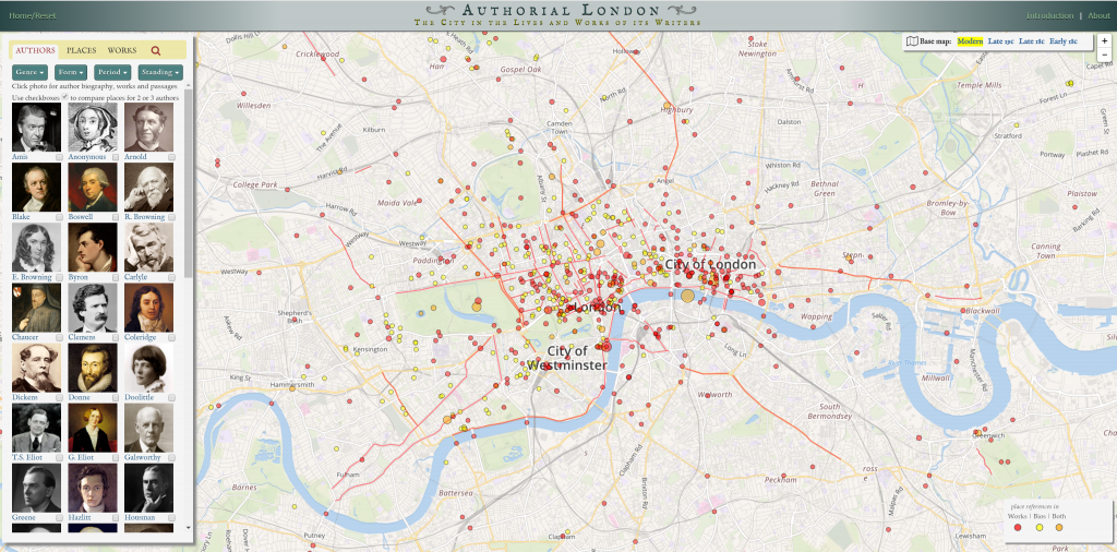
Authorial London presents geographical references from the literary works and lives of 14th to 20th century authors. The first type of data point is biographical and represents important places in the authors’ lives including where they were born, buried, lived, etc. The second type of data point is literary and represents places taken from literary works.
These literary data points were collected by reading 40 diverse texts. For a place to be added to the list, the passage mentioning it must contain enough of a description to make the place meaningful and progressive to the plot. If a place were repeated later in the text, it would only be included a second time if it was in correlation to a new, secondary location.
After gathering these geographic references from literary passages, Authorial London georeferenced these data points and used them to construct a geotagged corpus. To learn more about each location, 690 text files were ran through Project Gutenberg which provided some history on the existing locations and added new, related places to the list. To avoid falsely identified places or duplicates, the original literary passages were re-read.
In the end, 2795 literary references were transformed into 1013 data points. Some of these references were trimmed or combined with others if they had different phrasings, but ultimately represented the same location. Google Maps and Nominatim geocoding were used to service 2/3 of the data, then the remainder of the 1013 points had to be sorted manually.
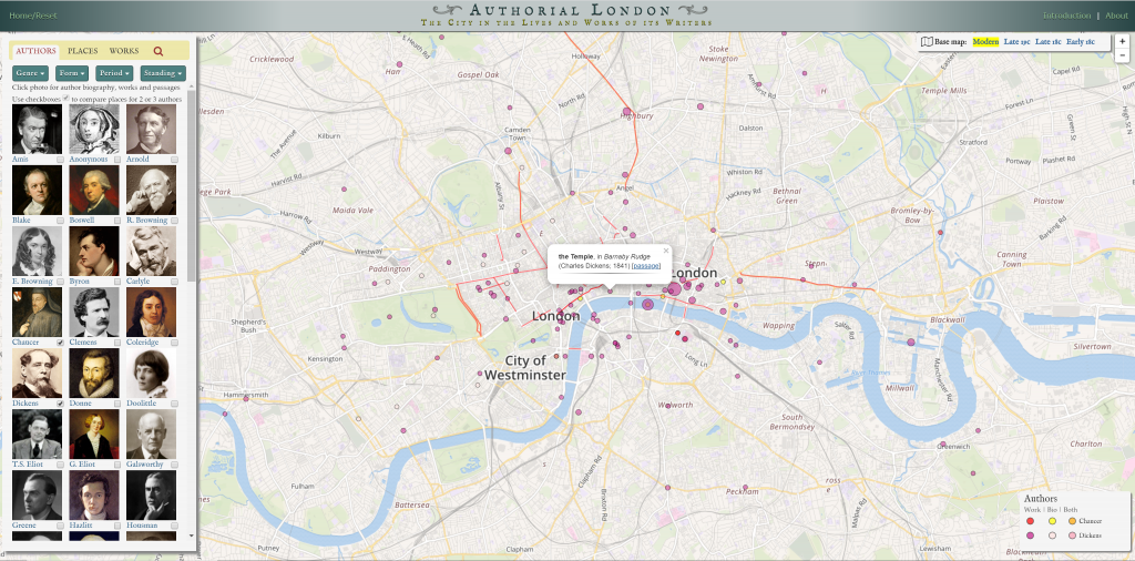
In their geotagged corpus, Authorial London uses an interactive model to present their data. There is a combination of clickable lines and dots, the lines representing roads and the dots representing places. When a shape is clicked on, information comes up about the work(s) that mention that particular location or which author’s life that location pertains to.
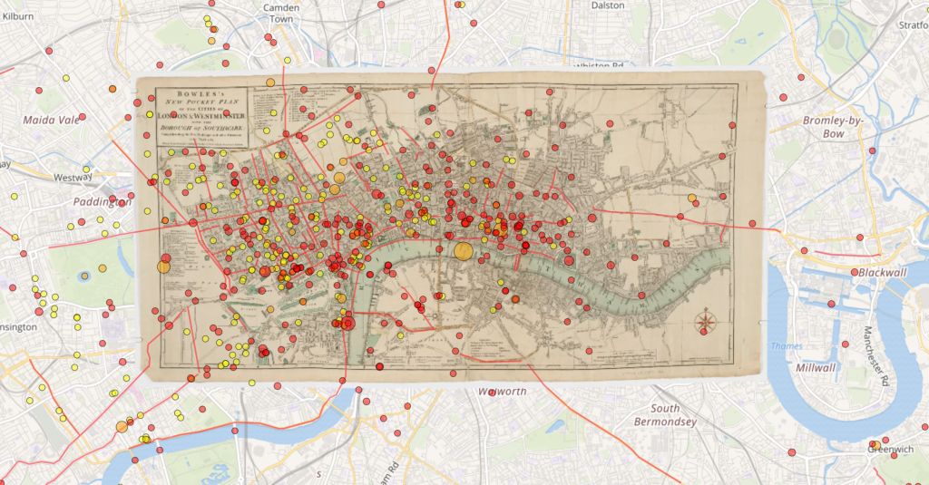
These data points can be individually clicked on, or filters from the sidebar can be used to compare authors’ works to each other, find works or authors by place, or find places or works by author. On the right-hand side of the screen, maps from late 19th Century, late 18th Century, or early 18th Century can be overlaid the map of present-day London.
2 replies on “Exploring Literary London”
Your description of the process stage of this DH project is extremely effective! You distinguish and highlight each aspect of the process from data to finished product in a way that thoroughly communicates the amount of labor and attention to detail paid by the creators. Furthermore, I like that you linked to Project Gutenberg as well, as it makes it convenient to access for those who did not analyze this project.
Wow, that’s amazing! I had no idea something like this existed. You do a really good job of conveying the multitude of sources used to create the data points on this map.