From the Commonplace Book:
The development of our index map was carried out through ArcGIS Pro, a software program specializing in the exploration, analysis, and sharing of spatial data. Our primary source of data for this project was the Sanborn Fire Insurance Maps from Faribault, Minnesota which were accessed through the Library of Congress digital collections. These maps provided detailed information regarding the urban layout of the city, street names, buildings, property lines, and general infrastructure.
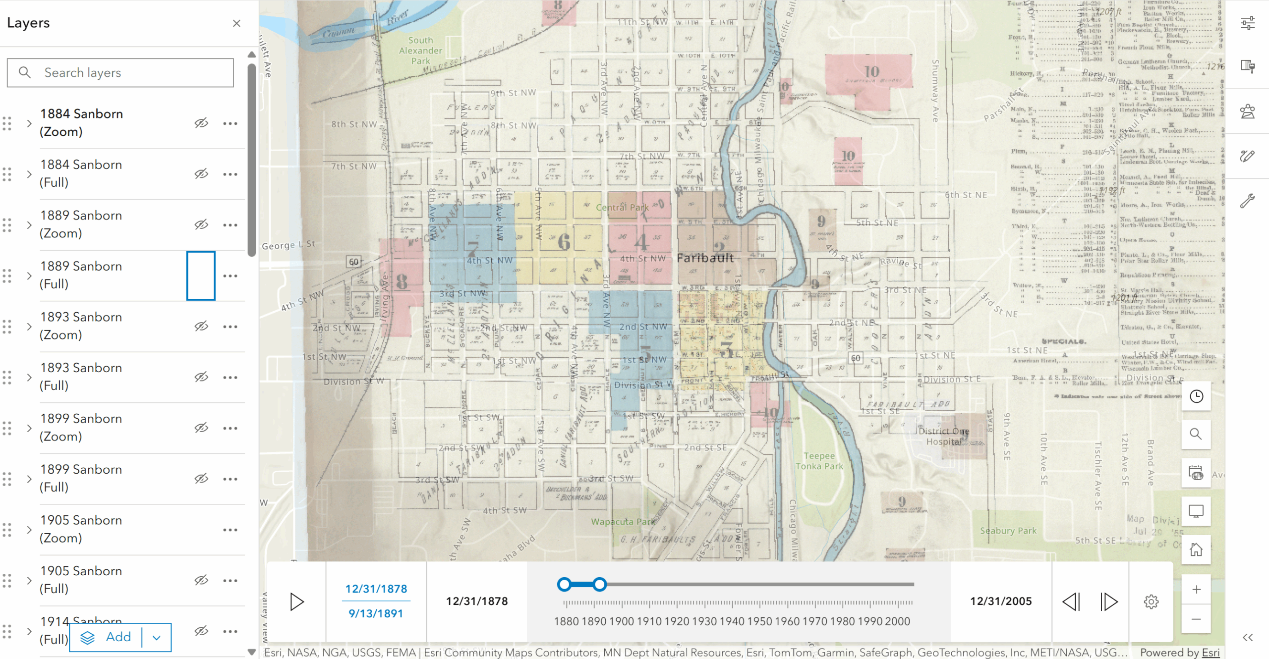
In order to align these historical maps, the tutorial Georeferencing a Historical Map in ArcGIS Pro – LibGuides at Van Pelt and Opie Library outlined the process of adjusting and overlaying the Sanborn maps onto the appropriate coordinate system. Each map was then manually georeferenced using railroads, bridges, and buildings as control points. In addition, we followed a tutorial by Chris Saladin that provided instructions on how to export ArcGIS project packages as well as create tile layers for ArcGIS Online. This tutorial was utilized to compile the Sanborn maps onto ArcGIS Online, forming an interactive index map that demonstrates the historical progression of Faribault from 1884 to 1921.
We ran into several difficulties while working with ArcGIS Pro, which meant that this part of the project took the bulk of our time. First, we forgot to save our georeferences before exporting the tiles to ArcGIS Online, which meant we had to redo all of our work. Then, once we correctly saved our georeferences, we faced an issue with local caching on ArcGIS Pro that prevented us from exporting our tiles. We were able to get this figured out with the assistance of Wei-Hsin Fu from Carleton’s GIS Lab. Aside from these two obstacles, we were successful in using ArcGIS Pro and are proud of how quickly we picked it up.
To create a more interactive and presentable final deliverable, we produced a StoryMap to show off our work from the term. We used this Keewanah map project, which demonstrates how to effectively use sliders and sidecars in StoryMaps, as a model. Explore our StoryMap below to get a better sense for how we developed our index map and how our project could be used in the future.
