
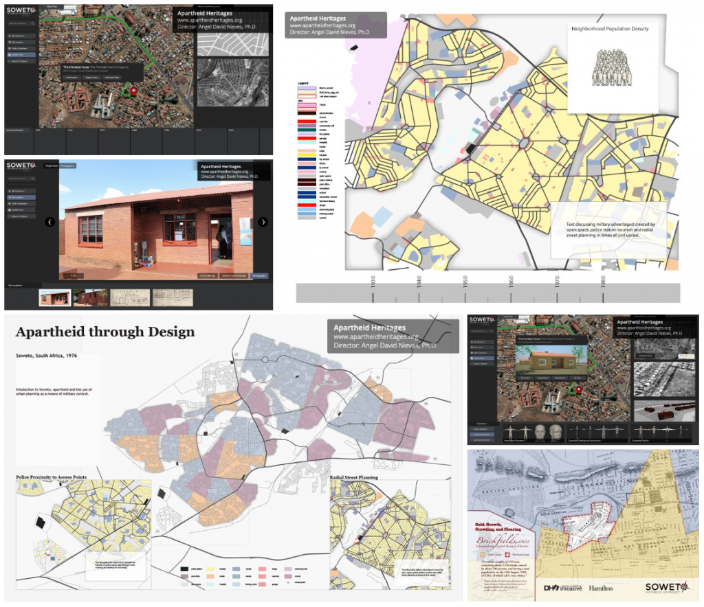
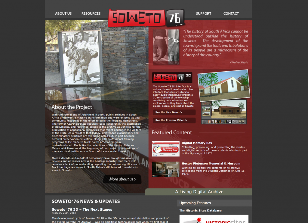
“Apartheid Heritages” is a multi-scale digital project that seeks to show, through GIS mapping, virtual environments, and a number of other methods, a deep look into the lives of the residents of Soweto in Apartheid South Africa. Soweto is a township outside of Johannesburg that pretty much exclusively housed black South Africans during the apartheid era. The most prominent subdivisions of the “Apartheid Heritages” project are the Soweto Historical GIS Project (SHGIS), an interactive, “multi-layered historical geographic information system database that explores the social, economic, and political dimensions of urban development under South African apartheid regimes (1904-1994)”, and Soweto ’76, a virtual Soweto connected to various eyewitness accounts regarding the National Uprisings of 1976. I thought these were really cool ideas, as I have read a decent amount about townships such as Soweto, but I’ve always found it hard to visualize them given my blatant lack of experience with such oppression. Creating GIS maps and virtual environments provides a really cool way to bring those townships to life.
Sources
The “Apartheid Heritage” project was headed by Dr. Angel David Nieves, an Associate Professor at Hamilton College. He and “a team of scholars, practitioners, and student researchers from Hamilton’s Digital Humanities Initiative (DHi)” used various sources for each of their subprojects. For SHGIS, a collection of 39 largely unseen maps found at the National Archives of South Africa as well as many images recovered from the Archives and firsthand sources served as the main source of information. For the Soweto ’76 project, a combination of images from the same Archives and primary accounts of residents from the time period and participants in the Uprisings were used.
Processing
In both projects, the modeling software SketchUp (at the time owned by Google) and Blender were used to create manual models in 3D environments based on photographs and accounts. To order these structures in a viable recreation of Soweto, maps were scanned as a ground surface to determine spacing and such. SHGIS, however, is pretty unclear in what kind of software they used to do the bulk of the actual GIS mapping, but the creators explain that, as a newer project than Soweto ’76, they were able to use the experience of the first project to make decisions about the best ways to process their data.
Presentation
Funnily enough, when the Soweto ’76 project was ready for presentation, standalone software options for display of the result were not particularly numerous, so the creators had to be a bit thrifty to find the best way to present their work. They settled on using SketchUp’s “flythrough” feature to create a video presentation of their 3D environment, which actually ended up giving them the convenient opportunity to determine the exact path through the city that the user would get to see. However, over time they were able to convert their work to a unity-based display program that can be experienced by all. Part of Soweto ’76 is also presented as a standalone website. SHGIS, in contrast, was always a unity project, and although it was initially only available as downloadable software, it is now available as its own website as well. There are a number of interactive maps along with the virtual environment in its program.
All in all, this project is an ambitious and informative way of bringing the Archival data initially found by the creators to life as an experience for anyone to have. I hope it gets the attention it deserves. Thanks for reading!

Sounds like a neat project! I’ve never used Blender before, but I’ve heard of people using it. I’d be curious to explore the differences between it and SketchUp.