From the Commonplace Book:
Our project evolved quite a bit from start to finish. From the start, we encountered some challenges — not only in terms of scope and material available, but also on a theoretical level, as we thought about how to visualize the history we were researching in the form of a map. There is so much ambiguity and potential unreliability in the sources we were looking at that we were hesitant to use a software like ArcGIS, which can give information the appearance of a precision and authority that it doesn’t necessarily have. Depending upon sources from a settler perspective could simply reproduce the biases that were clearly influencing their writing.
As we considered alternative ways of mapping or conceptualizing the landscape, we returned to a pair of maps that our class had discussed prior to starting work on projects. The Native Lands map and the Bdote Memory Map are both mapping projects created from an Indigenous perspective, and both emphasized the shortcomings of an uncritical, traditional form of mapping.
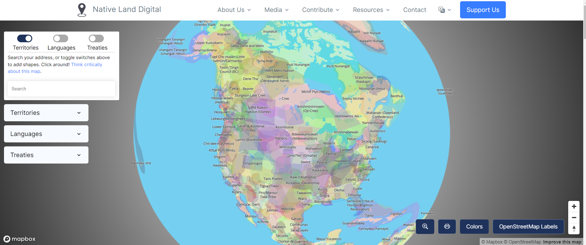
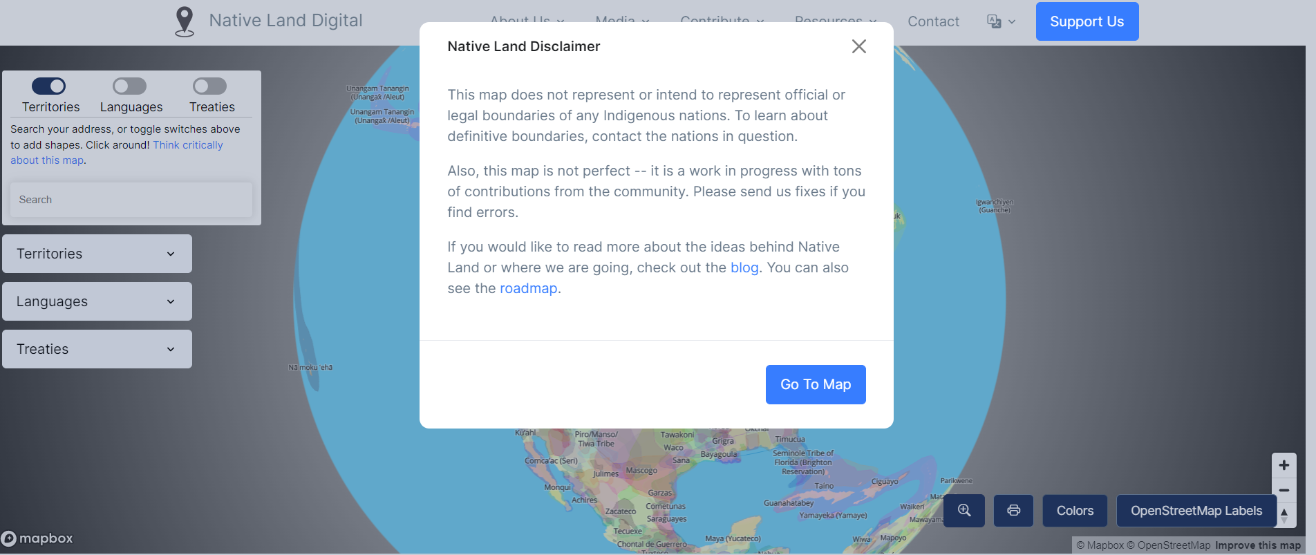
Native Lands (https://native-land.ca/) is a map of the globe showing the many overlapping territories and treaty areas of Indigenous groups around the world. While the map is somewhat overwhelming to look at, it emphasizes how the boundary lines we are used to seeing on a map are not as universal as they might appear. In reality boundaries and boundaries are messy, ambiguous, and often overlapping — as Victor Temprano writes, “the reality is just that borders don’t always function the same as the simplified maps imply when it comes to indigenous history; there is a lot more movement, overlap, and complexity than one nation on each chunk of land.”1 Even with these considerations, Native Lands still features a prominent disclaimer when one first enters the site — a reminder that projects such as these are always in progress, and cannot always tell the whole story. These were limits our project also faced, and were good to keep in mind when we considered how to frame and present our prototype.
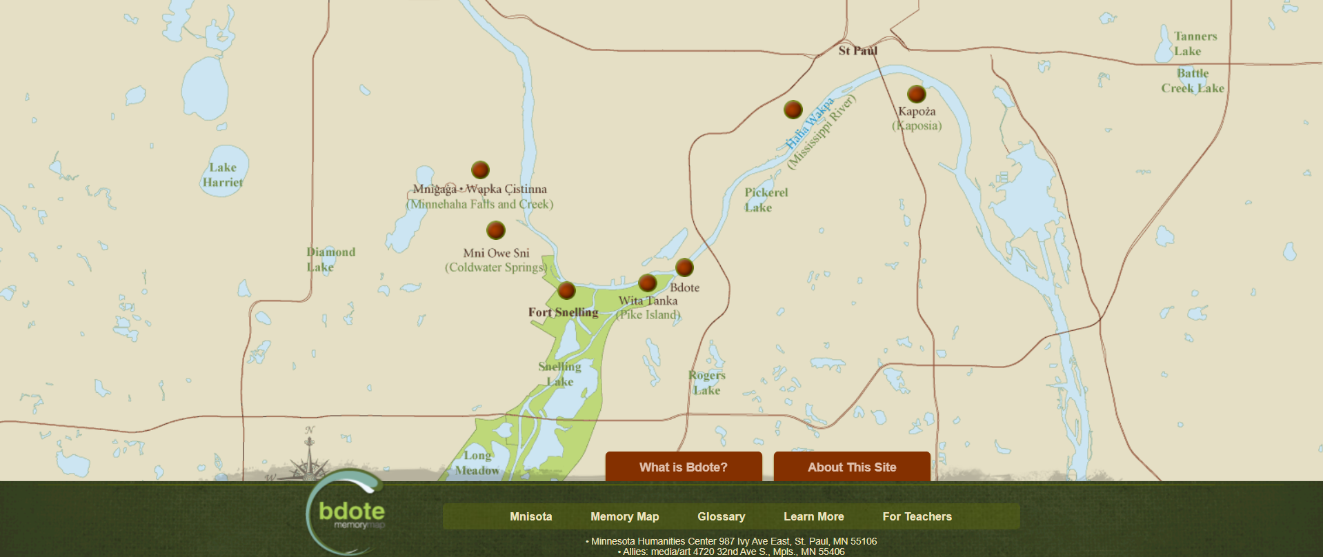
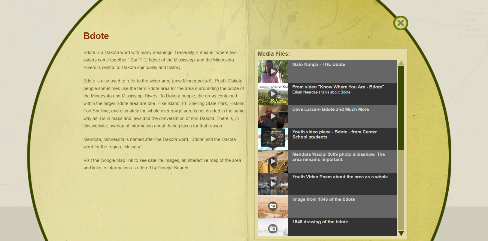
The Bdote Memory Map (https://bdotememorymap.org/) is focused specifically on Minnesota, and attempts to provide a deeper look into the relationship the Dakota people have with the land. Clicking on each point on the map opens a popup which provides further information on the location, and links to media which further explore the history and meaning of the place from a Dakota perspective. The map also has an important note on sources which echoed what Marcy had voiced concerning the use of primary sources: “Many of the primary resources that present Dakota history and identity, and US-Indian relations, are based on assumptions that not only arise from non-Dakota perspective, but actively exclude any indigenous perspective…. it is important to question the perspective from which the resource is created, and how that perspective shapes the presentation of facts.”2 This model, using points on a map to link to further information, is similar to the prototype we ended up making, although ours is much more sparse and preliminary.
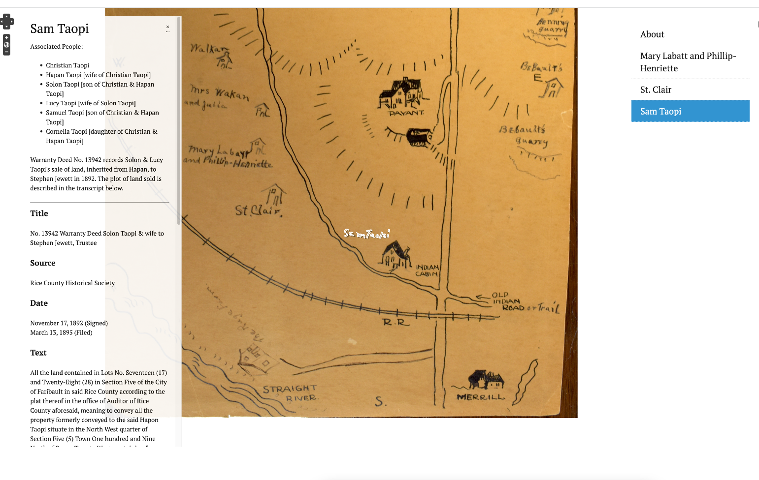
The first step we took in making our project deliverable was creating an Omeka library. This allowed us to digitize the warranty deeds we found in connection with the land shown on the map. We created item records for each deed, including photo files and transcriptions describing the land sold in the deeds.
We then used Neatline to create an interactive map. Rather than attempting to geolocate the hand-drawn map, we used it as a base layer, avoiding the problem of trying to input a map made from memory into a software that is inclined towards precision. We added SVG markup tracing the features that connected to the warranty deeds, which could be clicked on to open more information about the place and name in question. The pop-up box lists the names of people connected to the site, and links to the Omeka items related to that place and people.
This prototype models one way to envision an interactive version, digital of this map. The Omeka library could potentially be added to as a way to digitize more of the RCHS collections. As with many deep maps, this is still a work in progress. Rather than a finished product, we’ve created what we hope can be a starting point for future projects.
We would like to thank Marcy Averill for her helpful feedback on this project, and Sara Calhoun for her help in the research process.
- Temprano, Victor. “A Question of Borders.” Native-Land.ca, December 30, 2017. https://native-land.ca/a-question-of-borders/.
- “Learn More | Bdote Memory Map.” Minnesota Humanities Center. Accessed June 2, 2023. https://bdotememorymap.org/learn-more/.