From the Commonplace Book:
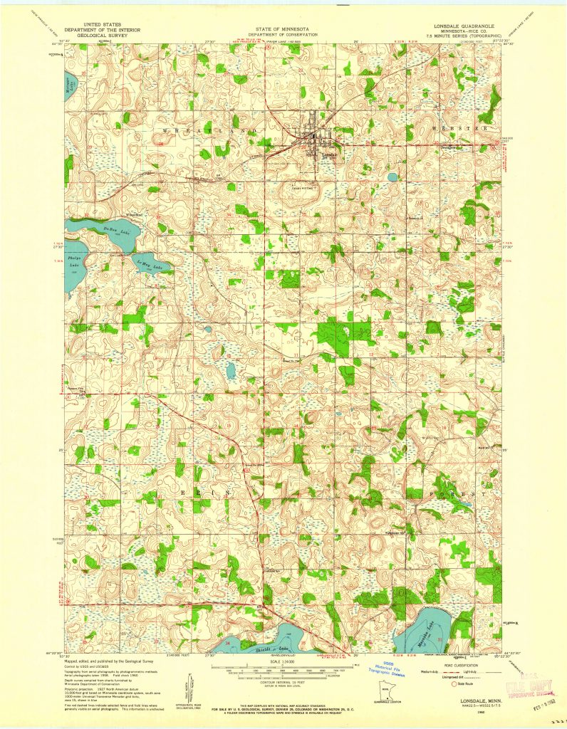
The Lonsdale quadrangle is located west of Northfield. It encompasses the town of Lonsdale, as well as the townships of Erin, Wheatland, and Forest. When European settlers first arrived, the land was full of marshes and “Big Woods” forests. Today, little of that remains. This deep map seeks to explore the change of the natural landscape looking back through time.