From the Commonplace Book:
Our final product for our community partner, the Northfield Public Library, consists of two ArcGIS StoryMaps that narrate the Cannon River’s past, from its geological and ecological history through human use and settlement, with an emphasis on Bridge Square area and the Ames Mill Dam. We present a symbiotic relationship between the river and humans leading up to the present. The library will potentially use this as part of the basis for a public art and placemaking project around the Cannon riverwalk area.
We engaged with primary and secondary sources about the Cannon River, Bridge Square, and the Ames Mill, utilizing the Northfield-Rice County Digital History Collection, as well as historical newspapers and records as the foundation of our exploration. Additionally, we used historical maps and integrated them into ArcGIS mapping software in order to explore historical representations of the river.
Based on these sources, we based the next stage of our research and creation on different themes. We focused mainly on geologic/environmental river change, Indigenous interaction with the Cannon, and the Northfield-Cannon relationship. We could not find extensive sources about Indigenous interaction specifically with the Cannon, so we decided to combine what we did find with the Northfield-Cannon theme. We then ended up with one map that focuses mostly on the changes to the river through human use and one map that focuses on the river’s effect on humans. The latter is especially focused on the mill and Bridge Square, as this is the focus area for the library.
Our research into the changing course of the Cannon River was inspired by geologist Harold Fisk’s 1944 Meander Maps and the modern LiDAR equivalents to explore the way in which the river has become less sinuous over time. The role of human construction on the Cannon, specifically dams and floodwalls, has had significant impact on the Cannon’s changing flow.
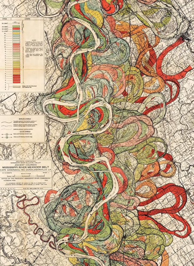
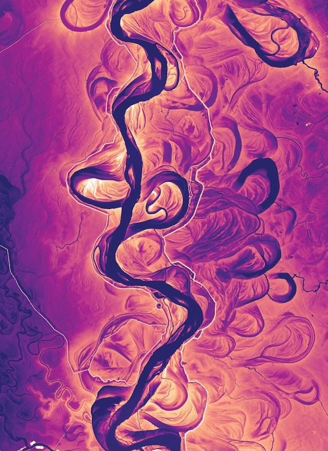
We were not able to utilize LiDAR data around the Cannon to explore historical river flow patterns, but it remains a viable avenue of research and visualization for other scholars interested in the historical geology of the river. A special thanks to the Emerata Charles L. Denison Professor of Geology, Mary Savina, for sharing her own research on the changing course of the Cannon River, which inspired our further research into the geologic past of the river.