Apparently, no one used to care about rivers enough to map them.
That is what I discovered recently, when I attempted to find a topographic map – or at least a visual – of the area surrounding Lyman Lakes before Lyman Lakes were created. I was surprised to discover that there was almost absolutely nothing:
- First, I searched the USGS map database to see if I could find some historical topo data. Sadly, the earliest topo data that existed for the Northfield area was taken in the 1950s – long after Lyman Lakes were created.
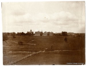
- Next, I researched the online archives to look for maps and images. The only image from pre-Lyman Lakes I found was one I had already seen, and is not taken from a great angle for mapping purposes:
- Finally, I turned to the people who really know what they’re doing: the Carleton archives. I ventured bravely to 1st Libe (squeaky shoes and all) to discover two things:
- Actually, quiet hours don’t start until 5pm, so it wasn’t nearly as scary as I expected it to be.
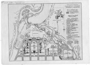
- Also, no one really cared enough about the river to map it, apparently, because the only maps of Lyman Lake that exist are of the area AFTER Lyman Lakes have been built. I did discover, however, that there have been two iterations of Lyman Lakes. One with a third island:
 And one, a little later in the late ’20s, without a third island:
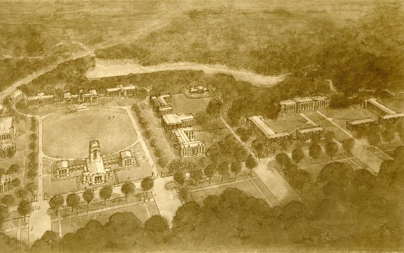
 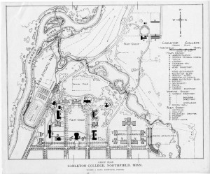 The closest thing to a map that could be found front he pre-Lyman Lakes era was this artistic rendering of the campus, which may actually be somewhat useful:
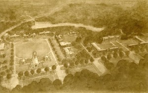
It was a long and arduous journey, but I now have some important information.
Next step: learn how to edit topo data!
Eliza,
Have you looked inside the various scanned books? There are images galore in the early Algols, for instance, and I’m sure that you could find many drawings and maybe some photos there of what the area looked like before 1916.
Trying to model Lyman Lakes is quite a feat. I’m surprised that no one decided to map the lakes when it was built. I had no idea that there was a third island in the first iteration of Lyman Lakes. Good luck on finding more resources and learning how to use topographical data!
I also find it quite interesting that there used to be a third island. Also, sorry that there is not much data. Good luck with your search.