Members: Maya Kassahun, Clarissa Smith, Ana Yanes Martinez, and Tonya Piergies
Definition of Project Topic: We are proposing to investigate what the Carleton campus might have been like by taking a look at architectural plans, proposals and planning documents for building projects that were considered before settling on those that are standing today.
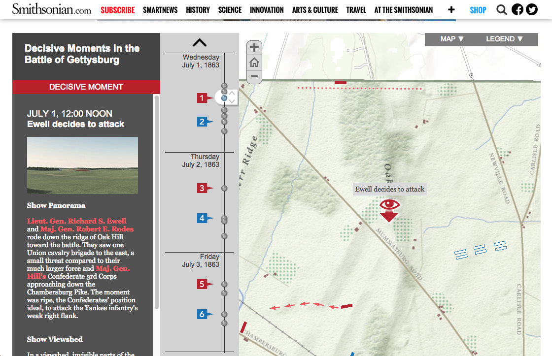
What We Want to Produce: We want to create a DH project similar to the Story Map featuring the Battle of Gettysburg, which walks visitors through how “the Civil War was won and lost” by walking through decisive moments on an interactive map. We are hoping to combine the functions of 3D models, a map, and a timeline to inform our audience about the history and formation of Carleton’s campus design.
Methodology
First we will examine the online archives for data that can be used. This includes old architectural plans and documents involving buildings that never came to fruition. If we are unable to obtain as much data as desired, we will continue our search in Carleton College’s physical archives.
We hope to use the data to identify the buildings that were never built, the reasons behind why they were never built, and decide how to recreate a digitalized “what could have been” Carleton campus.
Tools and Techniques
We plan to use excel sheets to record the metadata on the artifacts we find. We will do this in Dublin Core standard, so that we can later build a collection using Omeka.
We must also decide on which computer programs to create the interactive timeline-map with. ArcGIS and SketchUp seem to be the best option at this point.
Proposed Timeline of Deliverables
Between now and Friday of next week, we will search and collect data from Carleton College’s online and physical archives. We will be taking notes on the data/documents/etc. during this process. On Saturday, we will reconvene to discuss and analyze what we have found.
Link to DH(s):
Story Maps: https://storymaps.arcgis.com/en/
Decisive Moments in the Battle of Gettysburg: http://www.smithsonianmag.com/history/A-Cutting-Edge-Second-Look-at-the-Battle-of-Gettysburg-1-180947921/?no-ist=
https://contentdm.carleton.edu/cdm/
Unique Tag: TACMxHH
This seems like such a cool project to me! I’m really interested to see how it turns out. I’m wondering if there’ll be any patterns involving what changes to campus did and didn’t happen that you’ll be able to see. Why certain things on campus are how they are (why did they even bother making Lyman Lakes?) really makes me curious.
This is going to be such an interesting project, and a story map seems like a great way to present it. You may want to consider things like sculptures or landscaping as well as buildings– I once saw an exhibit on the planning of public sculptures (a number of which were, like your project, unrealized) and it was surprising how much debate, passion, and controversy went into proposals for statues! Who knows, maybe you’ll unearth a dramatic Carleton controversy.
Team What If,
I really like this concept and think you have the opportunity to tell stories that give fascinating insight into key moments in Carleton’s history by exploring these “might have beens.” I can’t wait to see what you come up with.
On the technological side, you might consider exploring Neatline, especially if you are building an Omeka collection anyway. It’s a plugin that let’s you turn your items into one or more spatio-temporal narratives. Do a little digging and compare it to what ArcGIS offers.
I’d be happy to help you explore options further.